Tired of Inaccurate Estimates and Costly Delays?
Manual surveys are slow, dangerous, and often inaccurate. It's time for a better way.
Safety Risks
Eliminate the need for personnel to climb unstable stockpiles, drastically reducing on-site liability.
Wasted Time
Capture data for your entire site in hours, not days, minimizing operational downtime.
Inventory Uncertainty
Base your financial reporting and sales forecasting on precise, verifiable volume data.
Ultramax Drone Services transforms your site data into a powerful business asset.
Our Data-Driven Drone Solutions
From precise volumetrics for quarries to stunning visuals for real estate.
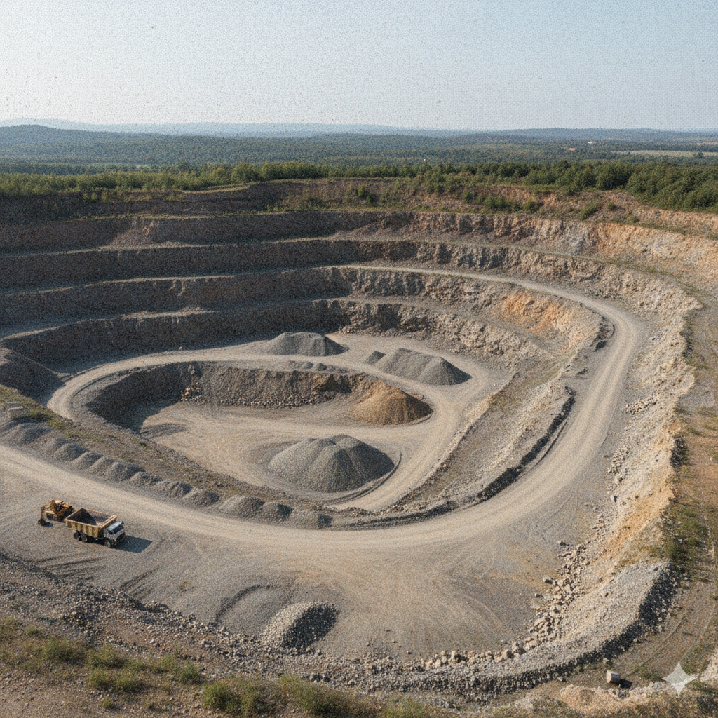
Aggregate & Stockpile Volumetrics
Get precise, recurring volume reports for inventory management. The perfect solution for Nova Scotia's quarries, gravel pits, and large construction sites.
Learn More →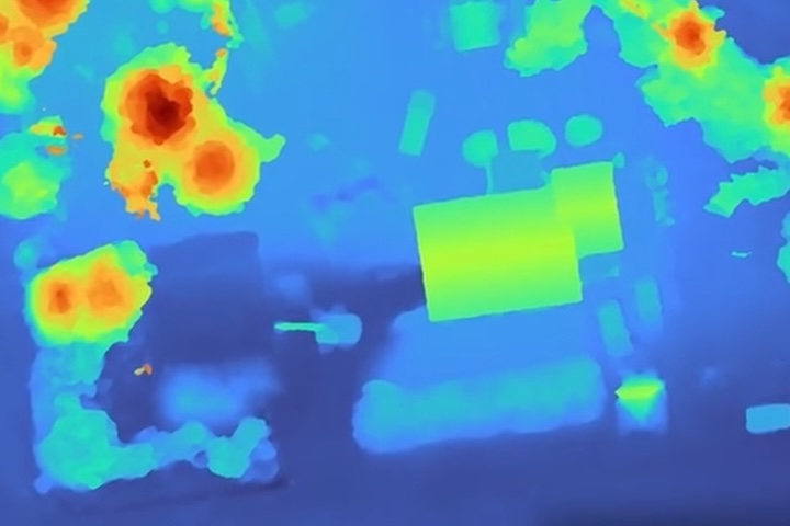
Construction & Site Monitoring
Monitor progress, verify earthworks, and enhance site planning with up-to-date aerial maps and 3D models. Keep your project on time and on budget.
Learn More →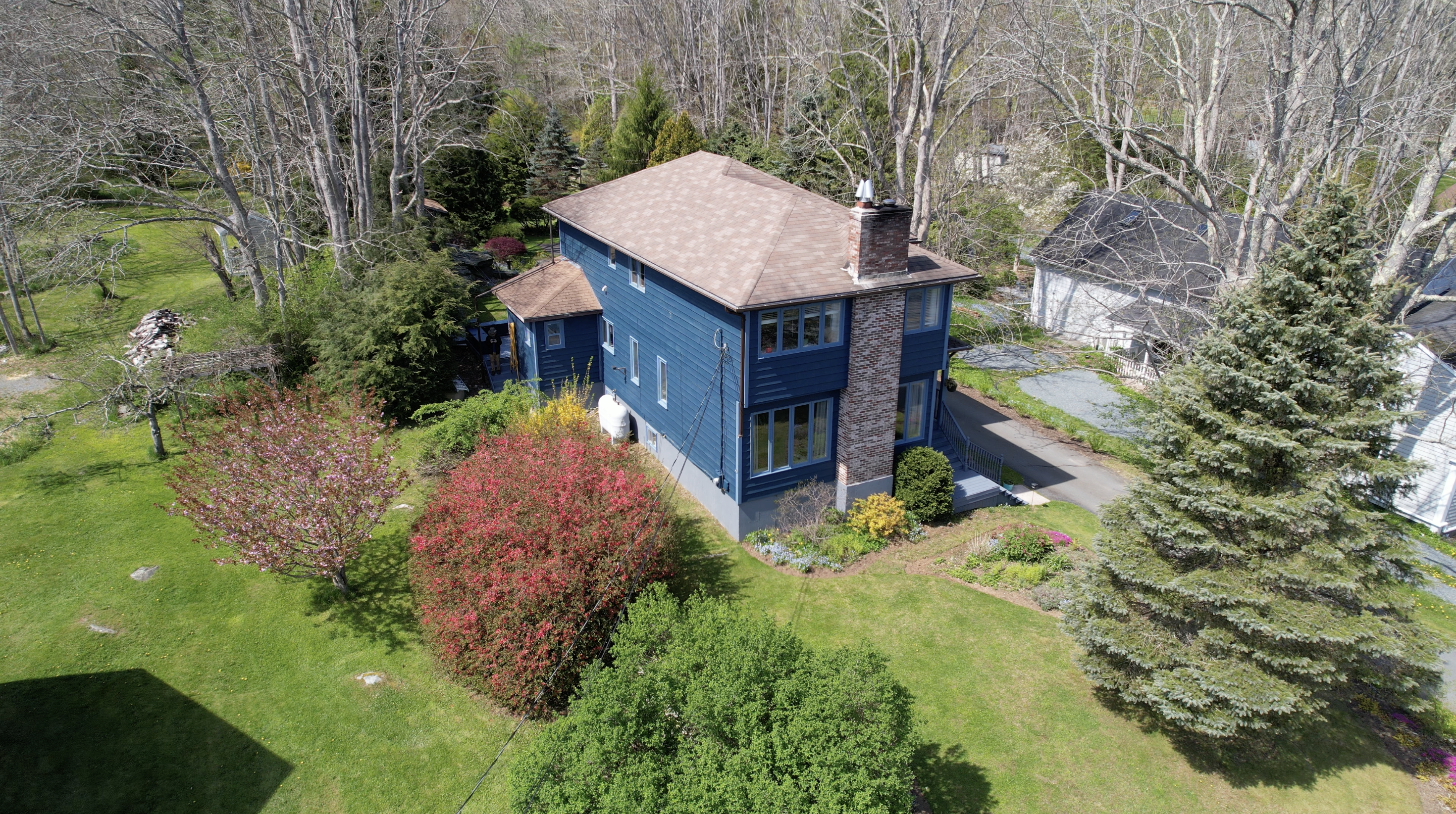
Premium Real Estate Media
Showcase large properties, farms, and waterfront estates with breathtaking aerial photography and video that captivate potential buyers.
Learn More →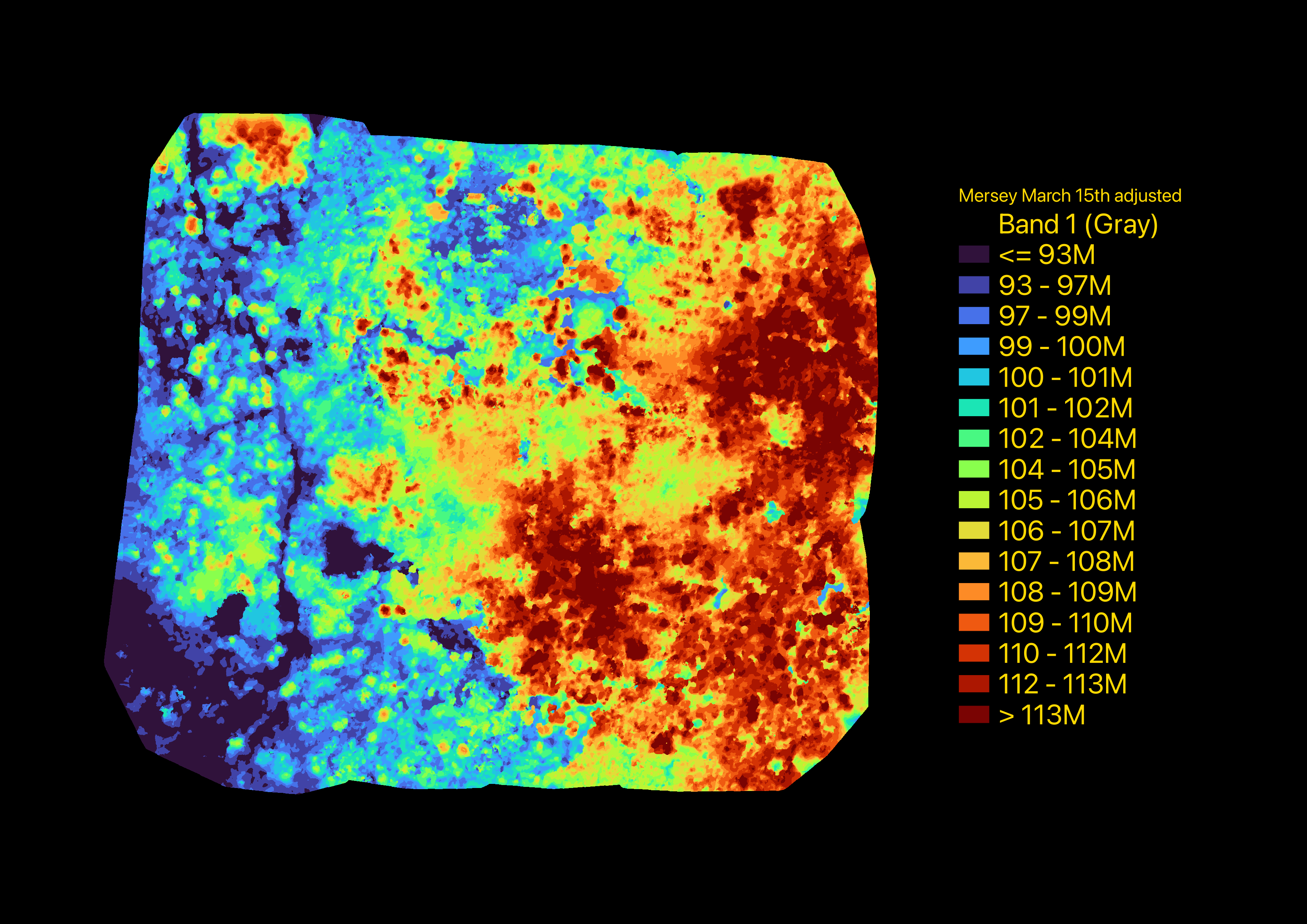
Forestry & Woodlot Management
Assess timber value and optimize harvesting with detailed canopy height maps for Nova Scotia's woodlot owners.
Learn More →From Takeoff to Data in 3 Simple Steps
1. On-Site Capture
We fly your site quickly and safely, typically in under two hours, with zero disruption to your operations.
2. Data Processing
Our specialized software transforms aerial images into highly accurate 3D models and orthomosaic maps.
3. Report Delivery
You receive a detailed, easy-to-understand report with the critical data you need to make informed decisions.
Why Choose Ultramax?
Unmatched Accuracy
Centimeter-level detail you can rely on.
Enhanced Safety
Fully licensed and focused on risk mitigation.
Rapid Turnaround
Get your actionable data in days, not weeks.
Local NS Expertise
We understand the unique terrain and needs of the region.
"UltraMax Drone Services did an excellent job getting the footage needed. There were a few details for the job that made for specific working windows. UltraMax worked within the constraints. Communication was great as well!
- Keenan H
Local Guide
Ready to Unlock the Power of Aerial Data?
Let's discuss your project. We provide free, no-obligation quotes tailored to your specific needs. Fill out the form or give us a call today.
(902) 350-3010
ultramaxdrones@pm.me
Proudly serving rural Nova Scotia